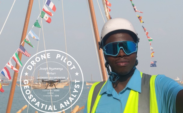
Drone Pilot • GIS Analyst • AI Enthusiast
"I fly the skies, read the land and build what the data reveals"
Years Experience
Flight Hours
Countries Operated
Omdena Projects
From drone operations to GIS contracting and AI collaboration across diverse sectors, each organisation has shaped a unique chapter of professional growth.


The platforms, languages and tools powering every flight, map and model.


A curated snapshot of expertise, curiosity and ongoing contribution.
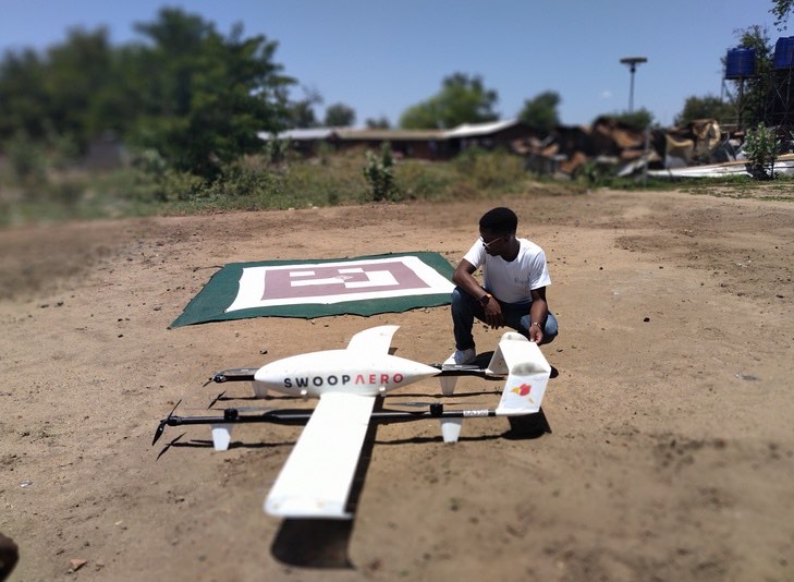
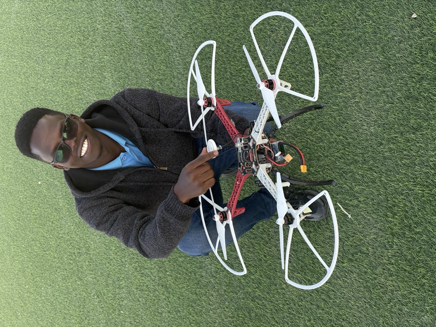
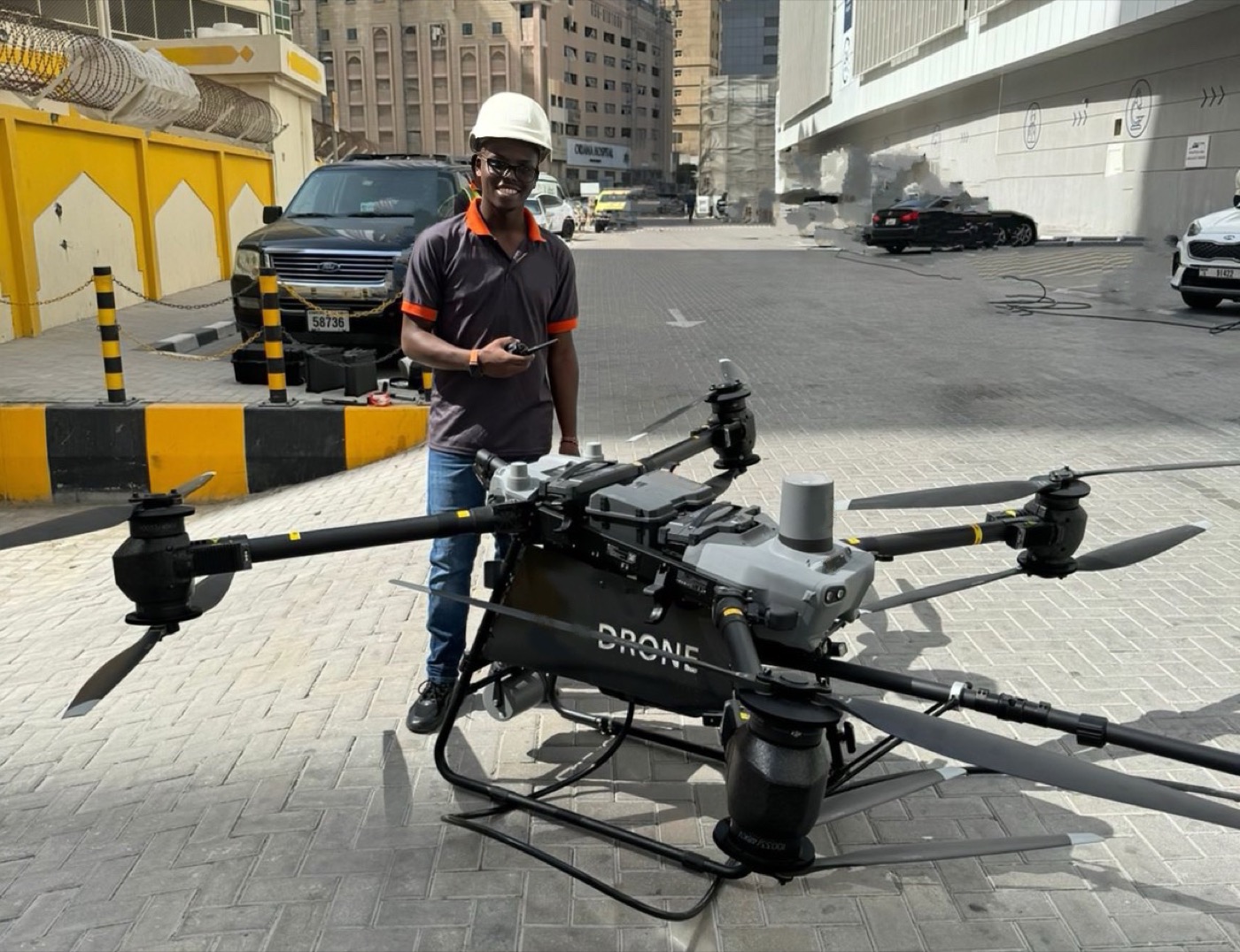
Delivering precision aerial services from mission planning and flight execution to processed imagery and actionable spatial reports.
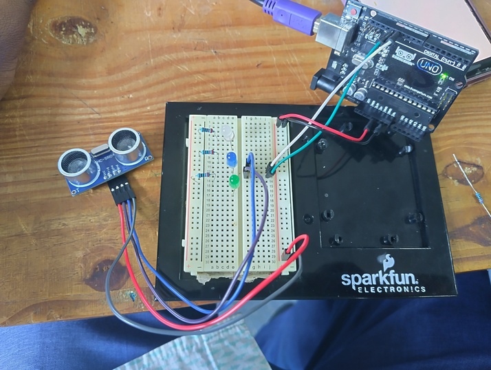
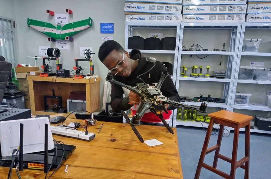
Building, configuring and troubleshooting UAV systems for industrial deployment from firmware programming to sensor calibration and field-ready maintenance.
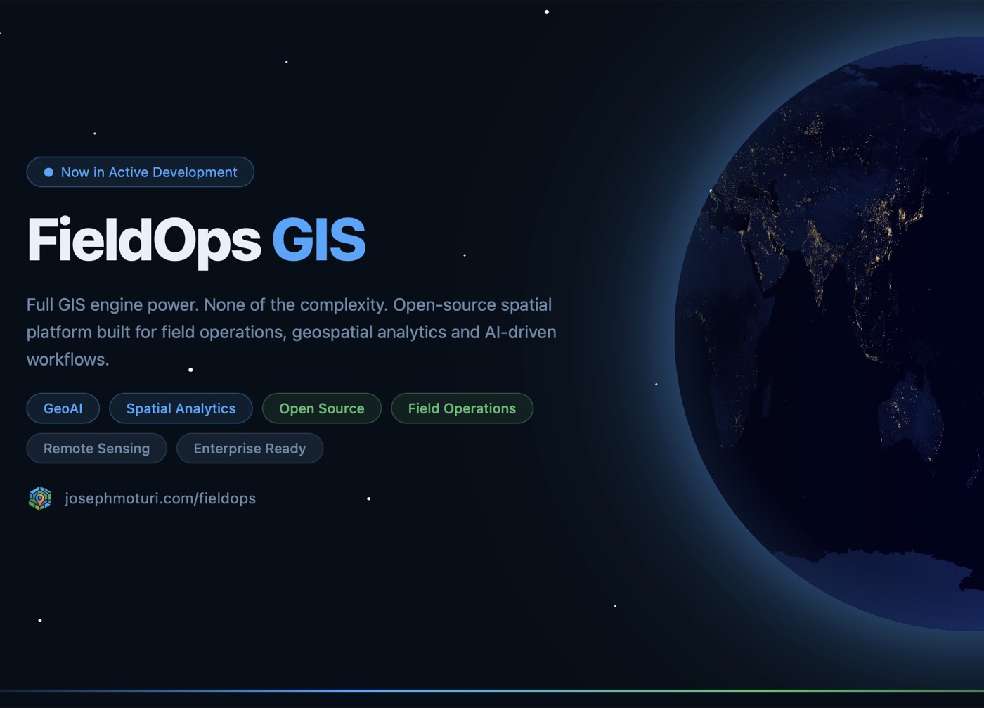
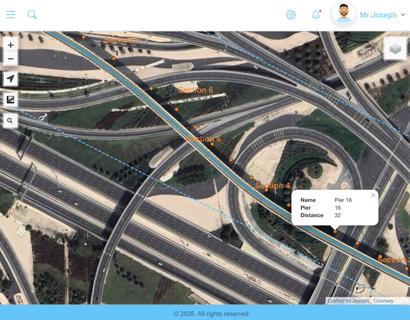
Crafting interactive WebGIS applications and spatial dashboards that turn complex geospatial data into clear, accessible web experiences.
Transforming raw spatial datasets into compelling visual stories through Streamlit dashboards, map interfaces and charts that drive informed decisions.
Training models to see what the eye misses. LULC classification, object detection and pattern recognition applied directly to drone and satellite imagery.
Giving back through knowledge by guiding the next generation of GIS analysts and drone operators via Omdena projects and open community initiatives.
Seeing beyond the visible spectrum by deploying thermal sensors on UAVs to detect heat anomalies in buildings, solar farms and critical infrastructure.
Interpreting the Earth from above by extracting land cover, vegetation health and environmental change signals from satellite and drone-acquired imagery.
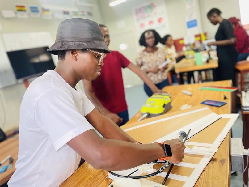
From digital blueprint to physical part by designing and printing custom drone frames, mounts and prototypes using CAD software and FDM 3D printers.