Each panel is purpose-built — no settings buried three menus deep.
🗺️
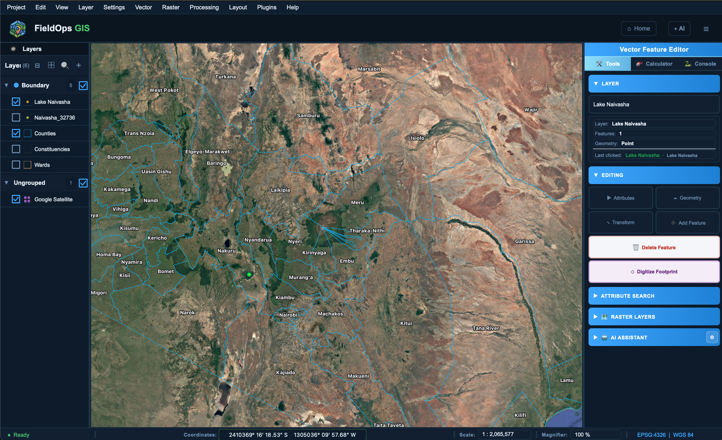
Map Canvas
Full QGIS-powered map canvas with pan, zoom, feature picker, coordinate display and scale control.
📂
Layer Panel
Symbol swatches, search/filter bar, inline opacity slider, group drag-drop reordering — closer to the original QGIS panel than ever.
🌐
Browser Panel
Stable custom browser with XYZ tile support (OSM, Google Satellite, Stadia and more), Favourites, and lazy filesystem navigation.
🔍
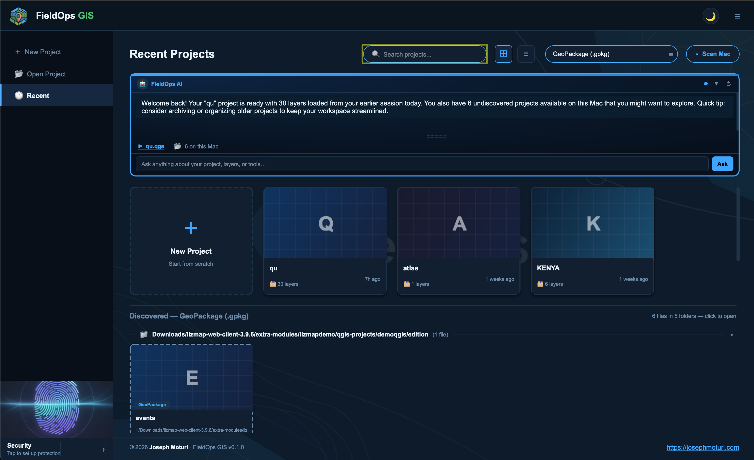
Project Scanner
Scans your Mac for spatial files automatically using Spotlight or recursive search — grouped by folder, no flash or lag.
✏️
Digitising Tools
Add, move, delete features with snapping. Full vertex editor. Works on any vector layer in edit mode.
📋
Attribute Panel
Inline attribute editing in a right-side dock. Edit field values directly without opening a full attribute table.
🎨
Layer Properties
Custom 5-tab crash-free dialog: Information, Fields, Symbology (categories & ranges), Rendering (opacity, scale, blend), and Metadata.
🤖
AI Assistant
Integrated FieldOps AI dock — ask questions about your project, get spatial analysis suggestions, and more.
🔐
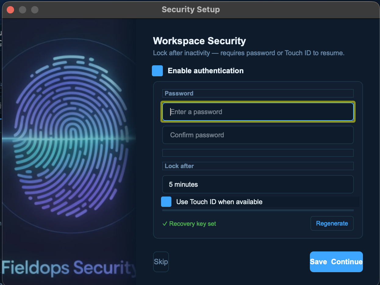
Touch ID Lock Screen
Biometric authentication on macOS. Auto-triggers when lock screen appears. Falls back to password gracefully.
🗒️
Print Layout Designer
Create print-ready map layouts with title, north arrow, scalebar and legend. Export to PDF or image.
🔌
Plugin Manager
Load and manage QGIS-compatible Python plugins inside FieldOps GIS without touching the main QGIS install.
🌙
Dark / Light Theme
Full theme system — switch between dark and light modes across every panel, dialog and toolbar.